Pyuthan Khalanga (Pyūthān)
Pyuthan is a municipality in the Pyuthan District in the Lumbini Province of Nepal. This municipality is named after the district name Pyuthan. It is also the major market center and the administrative center of district. The municipality was established on 18 May 2014 by merging the existing VDCs Khaira, Dakha Kwadi, Bijaya Nagar, Bijuwar, Dharmawati, Maranthana and Khalanga village development committees. In 2017, when GoN restructured the local level bodies into 753 units, Pyuthan Municipality was also restructured excluding ward no. 1, 2, 3, 5 and 18 from old structure, further two other VDCs; Majhkot and Jumrikanda added, Khalanga separated and managed the municipality into 10 new wards. Nayabajar Jumri and Bijuwar are the major markets of Pyuthan Municipality.
The town is situated about 500 meters above the intensively cultivated floodplain of Jhimruk Khola about 15 kilometers north of the Mahabharat Range in the Middle Hills. Besides expansive views of Jhimruk valley, there are limited views of a few peaks in the western part of the Dhaulagiri range off to the north. The town is populated by government officials, soldiers, and police of Magar and other "hill tribes" and their mostly Chhettri officers, by Newar merchants, by civil servants recruited mostly from local Bahun and Chhetri castes, as well as menial castes who labor as tailors, cobblers, blacksmiths and construction workers.
Before King Gyanendra was removed from office in 2008, this district center was virtually a royalist island in a republican sea. Pyuthan district was the home base of Mohan Bikram Singh who was a charter member of the Communist Party of Nepal. Singh did extensive organizational work in his home district and other parts of Rapti Zone, resulting in local opposition to the Shah dynasty that largely ran the country. Although M. B. Singh was marginalized in leftist politics before the Nepalese Civil War broke out in 1996, his organizational work helped make Rapti Zone the "heartland" of the insurgency and left the district center vulnerable and isolated for the duration.
Pyuthan has scheduled bus service via the east-west Mahendra Highway and a spur road from Bhalubang along the West Rapti River. This road has been paved for all-weather use.
Pyuthan Khalanga (खलङ्गा) means military barracks. It generally signifies a military post larger than a kot (कोट).
Map - Pyuthan Khalanga (Pyūthān)
Map
Country - Nepal
 |
 |
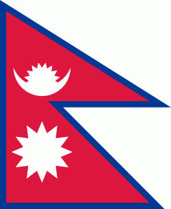
| Flag of Nepal | |
The name "Nepal" is first recorded in texts from the Vedic period of the Indian subcontinent, the era in ancient Nepal when Hinduism was founded, the predominant religion of the country. In the middle of the first millennium BC, Gautama Buddha, the founder of Buddhism, was born in Lumbini in southern Nepal. Parts of northern Nepal were intertwined with the culture of Tibet. The centrally located Kathmandu Valley is intertwined with the culture of Indo-Aryans, and was the seat of the prosperous Newar confederacy known as Nepal Mandala. The Himalayan branch of the ancient Silk Road was dominated by the valley's traders. The cosmopolitan region developed distinct traditional art and architecture. By the 18th century, the Gorkha Kingdom achieved the unification of Nepal. The Shah dynasty established the Kingdom of Nepal and later formed an alliance with the British Empire, under its Rana dynasty of premiers. The country was never colonised but served as a buffer state between Imperial China and British India. Parliamentary democracy was introduced in 1951 but was twice suspended by Nepalese monarchs, in 1960 and 2005. The Nepalese Civil War in the 1990s and early 2000s resulted in the establishment of a secular republic in 2008, ending the world's last Hindu monarchy.
Currency / Language
| ISO | Currency | Symbol | Significant figures |
|---|---|---|---|
| NPR | Nepalese rupee | ₨ | 2 |
| ISO | Language |
|---|---|
| EN | English language |
| NE | Nepali language |


